GeoChat is a collaboration tool that allows anyone to chat, report, and get alerts on their phone.
It is designed to enable self-organizing group communications by allowing users to link the field, headquarters, and the local community in a real-time, interactive conversation visualized on the surface of a map. GeoChat is a tool for group communications based on SMS, email, and Twitter.
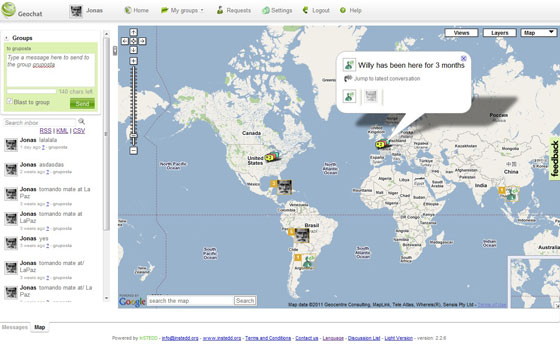
People use GeoChat to simplify team communications, logistics and data reporting, and they can extend their own software applications using the open APIs. GeoChat is a flexible open source group communications technology that lets team members interact to maintain shared geospatial awareness of who is doing what where — over any device, on any platform, over any network. GeoChat allows you and your team to stay in touch one another in a variety of ways: over SMS, over email, and on the surface of a map in a web browser.
Whether you are sitting at a computer with a high-speed Internet connection, or on the go with your mobile phone, GeoChat lets you react to events on the ground with maximum agility, forming cross-organizational virtual teams on the fly, linking field to headquarters, and keeping everyone on your team connected, in sync, and aware of who is doing what, and where.

Why Use GeoChat?
GeoChat is proven in the field, is simple to use, and scales with your needs. GeoChat is field-proven with users that range from hundred of community health workers in rural villages to tech-savvy disaster response teams. In most countries, you don?t need a computer to get started, and in some using GeoChat is toll-free.
Take a Tour!
Start using it today! You can create your groups and invite people. GeoChat connects to multiple wireless phone operators, aggregators, email and twitter to send and receive messages. GeoChat works 24×7, with no computer, from any phone.
How Does It Work?
- Step 1: Register with GeoChat either online, by email, or by SMS
- Step 2: Create a new GeoChat group and invite your friends
- Step 3: Send messages to one another, or share them with the entire group.
If you’re mobile using your cell phone, prefix a text message with your location — say your current address, or a latitude and longitude from a GPS – and GeoChat will place your icon on the map for online users to see. If you’re online in the browser, find a teammate’s icon on the map, click reply, and send a reply back to them over SMS.

Features:
- Create, join and participate in chat groups by SMS, email, or web browser.
- Translates location names sent by users to a position on a map
- Supports a variety of explicit location formats, as well as other user-defined tags.
- Subscribe a group to one or more RSS/ATOM feeds, and each new item will be broadcast to mobile users via SMS.
- Groups may be set as public or private.
- GeoChat Server is available both as a free download and as a hosted service.
- Twitter access via “geochat”, and domestic US gateway service via 44911.
- Dedicated international SMS gateway supported by 96% of the world’s mobile carriers.
- Optional “local gateway” mini-client that allows you to plug a local cell phone into your laptop, connect to the Internet, and allow users to send and receive text messages through the service via the local cell network, rather than using the international gateway.
Benefits:
- Lets you see, at a glance, who said what, when, and where.
- Allows geospatial ground-truthing, as your mobile team works to confirm, refute, or update data on your map.
- Allows mobile users to verify, refute, or update information live from the field
- Allows highly-connected users to share the benefits of their geospatial “big picture” view and push out relevant RSS/ATOM feeds to a barely connected users via SMS.
- Ensure that your teammates know where you are and what you are doing.
- Visualize your remote team on the surface of a map and interact with them.
- Works on any PC, Mac, or Linux PC capable of running Mozilla Firefox
- Works using any cell phone capable of sending and receiving SMS messages.