We are thrilled to be able to share with you some of the work that the InSTEDD iLab Latin America has been doing to help empower young Brazilians living in the favelas of Rio de Janeiro, to reduce the social and environmental risk factors in their communities. We’ve partnered with UNICEF, MIT and the Brazilian NGO CEDAPS, on a digital mapping project that allows the youth to create digital maps of their communities and then interact with that map by publicly tagging the issues they see. This cutting-edge mapping platform enables real-time data collection through web and mobile applications.
InSTEDD was thrilled to be involved in a project that had the potential to use innovative communication technologies to create positive social impact, while offering a promising perspective for growth, scale and replication elsewhere.
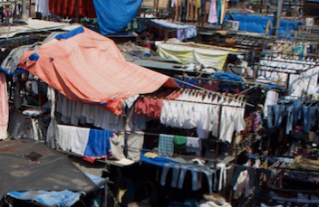
The story begins in five favelas in Rio de Janeiro, Brazil.

A photo of one of the favelas, Morro do Borrel
THE CONTEXT
A “favela” is the Brazilian equivalent of a slum. Usually they are an expansion, or more accurately, an overflow, of the city they border. According to the census data, around 6% of Brazilians, or 11.4 million people live in favelas. These communities are irregular settlements that usually lack access to basic services such as running water and electricity. Due to the lack of services and non existent city planning, the favelas are often overcrowded, polluted and unsanitary places to live. In addition, disease, infant mortality and crime rates are the highest in the country.
The burdens the people living in the favelas are compounded by the fact that the favelas are often near mountains and located just above sea level, making these communities that much more at risk for both disasters and socio-environmental risks, such as climate change related floods, landslides and natural disasters.
COLLABORATING WITH UNICEF, MIT AND CEDAPS
This project was born from a youth-led UNICEF initiative that was focused on digitally mapping environmental risk factors in the favelas of Rio de Janeiro. By the time the iLab Latin America became involved, UNICEF had already begun to work with CEDAPS, an organization with experience and strong relationships in the favelas. On the technical side, MIT had provided the technological platform for surveying, monitoring and mapping.

Working alongside MIT, UNICEF and the Brazilian NGO CEDAPS, the iLab Latin America is helping develop the Environmental Youth-led Risk Mapping Project in the favelas of Rio de Janeiro, Brazil.
We began implementing the project by conducting a series of workshops with young people from each of the favelas: Morro dos Prazeras, Morro dos Macacos, Morro do Borrel and Morro dos Uburus. The fifth workshop will be held in Rocinha.
In these workshops, the young people were trained on:
- how to use the MIT developed Android application
- what a risk factor is and how to be on the look out for them
- the overall importance of this type of project

One of the workshops where the youth were trained how to use the application
THE PROJECT: Rio Youth Mapping Project
The main idea behind this project was to create a simple, low cost way to allow the youth living in the favelas to digitally map the socio-environmental risk factors that threatened their communities. We needed to do it in a way that would be publicly visIble so that the government and the public could be aware and respond.
Here’s how it works:
With assistance from CEDAPS, young people from the favelas take tours around their communities and report various risk factors through an application on their cell phones. First, they identify the type of hazard, according to pre-established categories (such as broken infrastructure, unsanitary conditions or environmental degradation issues). Next, they use their mobile phones to take a picture of the problem they’re seeing and add a brief description. The cell phone detects their location, via GPS, and adds their data to a public website which contains all the when/where/what data that the youth collected.

The youth and Ives Rocha, from CEDAPS, taking tours around the favelas.
If an internet connection is available in the field, then the information is uploaded immediately in real time. If they don’t have an internet connection, then they go to the CEDAPS central office and connect their phones and upload all the data through the computer’s internet connection.
CREATING DIGITAL MAPS WITH KITES AND BALLOONS
In order to ensure accuracy, the maps that the youth were working with needed to be up to date. Unfortunately what was available for free were outdated satellite photos that didn’t offer the ability to zoom into the level needed to accurately map the hazards.

This shows how they attached digital cameras to kites and balloons as they captured photos of the favelas which they used to create a digital map.
As a solution to this problem, the platform included a way for the youths to create their own maps by compiling aerials photographs they took themselves. In order to get high quality and accurate maps, the youth had to get creative. They attached digital cameras provided by UNICEF to kites and balloons and sent them up over the favelas. The digital cameras were set to continuously shoot photos as they soared over the community, gathering updated and clear information that they could use to create a digital map.
This initiative allows young people from the favelas to be actively involved through the entire process: creating the maps, identifying hazards, geolocating them onto their digital maps and sharing the information with the public and government agencies so that they can begin to solve the problems.
Some of the problems included in these maps are:
- infrastructure and sanitary conditions (drains, sewers, waste, debris)
- garbage recollection insufficient services
- risk of landslides
- unprotected or unstable stairs
- bumps or obstacles that prevent access to ambulances
- precarious structures of columns and bridges that support houses
- lighting and electricity issues

Youth working with the kites they used to take the digital photos that they created the map with
Keep an eye out for Part 2 in this blog series where we will tell you about how iLab Latin America has contributed to solving technical issues on the platform, simplifying the interface of the application and increasing the usability of the tool.
MORE INFORMATION
For more information on this project, please explore the following links:
InSTEDD Website Project Description:
Learn more about this project here: instedd.org/map/favela-digital-mapping/
iLab Latin America Blog Posts (in Spanish):
Part 1: http://blog.ilabamericalatina.org/2012/02/trabajando-junto-con-unicef-en-la.html
Part 2: http://blog.ilabamericalatina.org/2012/03/trabajando-junto-con-unicef-en-la.htm